Studio Joost Grootens
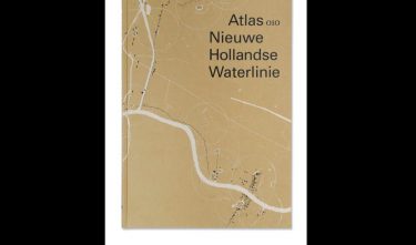
Atlas Nieuwe Hollandse Waterlinie
The project
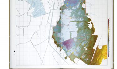
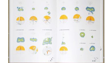
The Atlas Nieuwe Hollandse Waterlinie is the fifth atlas that Joost Grootens has made for 010 Publishers. Using four themes, the Atlas Nieuwe Hollandse Waterlinie shows how the fortifications and the inundation system of the New Dutch Waterline are situated in the landscape and what the mutual connections are. Grootens has raised the level of atlas-making even further by using metallic and fluorescent colours and innovative diagrams. For the New Dutch Waterline Atlas he developed a new palette of colours. The inks lie on the paper, which creates a certain depth. It also contributes to the tactile quality of the atlas.
Committee
As the creator of atlases, designer Joost Grootens stands within a typical Dutch tradition that goes back to the Golden Age. In the seventeenth century, cartographers from the Low Countries set the standard for the rest of the then known world. The Atlas Nieuwe Hollandse Waterlinie shows convincingly that the printed atlas has relevance even in the age of the Internet. The perfection of Grootens’ atlas cannot be achieved by means of digital media. Not yet, that is.